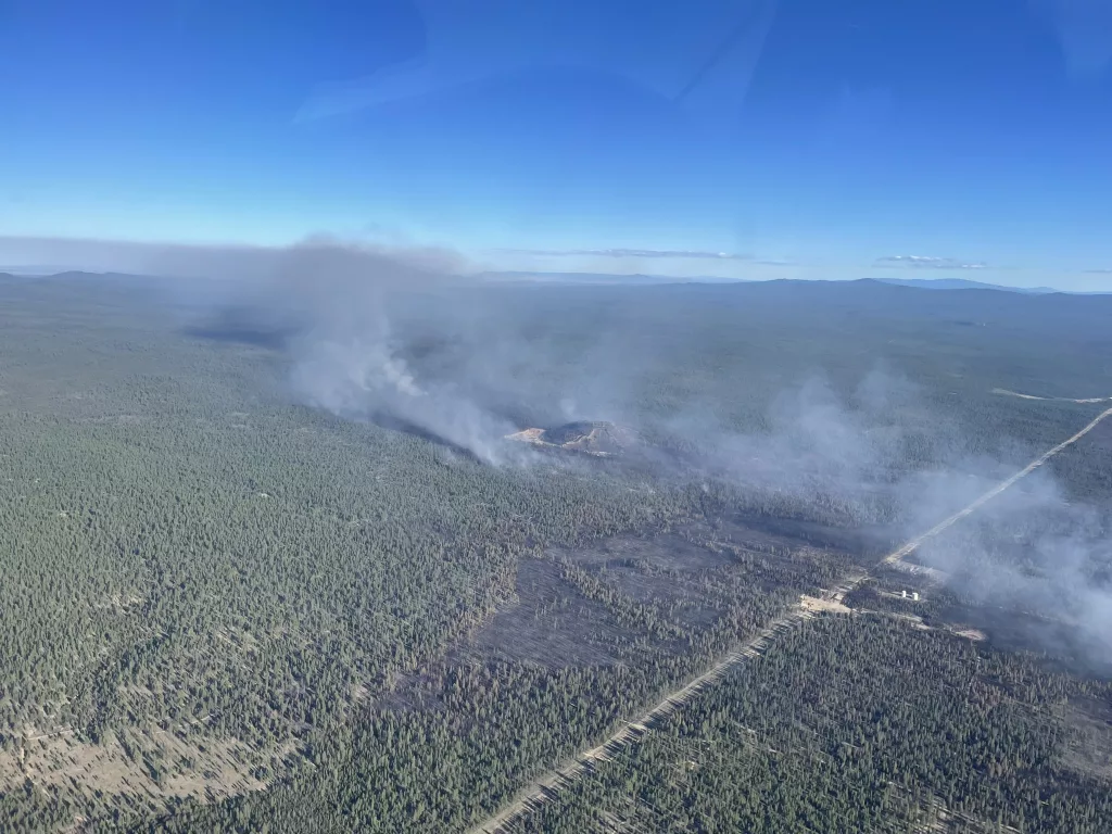
Central Oregon — Fire crews were able to increase containment on the Darlene 3 Fire during both day and night operations. A Central Oregon Type 3 team and the Oregon State Fire Marshal (OSFM) Red Team remain in unified command, and all incident personnel continue to focus on full suppression and containment.
The fire is currently 3,889 acres and 42% contained. Cooler temperatures and calmer winds during the day on Thursday allowed crews to increase containment lines with the help of dozers and retardant drops. Some spotting occurred yesterday to the east, but crews continue to aggressively seek and suppress any spot fires beyond the current containment lines. Crews have established patrols around the entire perimeter of the fire and will take advantage of the cooler, calmer weather over the next two days to harden containment lines and reduce the risk of flare ups within the burn footprint. Teams have been successful in protecting key community assets, including the La Pine Community Cemetery off Reed Road, power lines, a cell tower and the city’s water supply. Due to decreased fire threat to the community, fire managers were able to release some of the OSFM structural protection task forces to their home agencies.
A virtual community meeting will be held at 4pm today via Facebook, streaming live on Deschutes County Sheriff’s Facebook page. To watch, please visit https://www.facebook.com/DeschutesCountySheriff. This meeting will provide fire updates to community members and incident personnel will be available to answer questions. The meeting will also be broadcast live beginning at 4 pm at the Red Cross evacuation shelter at La Pine High School (51633 Coach Rd). For anyone unable to view live, the recording will be available on the Deschutes County Sheriff’s Facebook page.
As of 12:00 pm today, the Deschutes County Sheriff’s Office has reduced the evacuation level for Newberry Estates from Level 3 (Go Now) to a Level 2 (Be Set). Additionally, the area west of Hwy 97 and north of Burgess Road has been reduced to no evacuation status. As residents return to their homes, fire personnel ask that community members remain vigilant for emergency response vehicles traveling to and from the fire, and to give fire apparatus plenty of room especially as smoke in low-lying areas may affect visibility. A Level 3 evacuation order remains in effect for parts of the Deschutes National Forest, and fire personnel are asking residents and visitors to adhere to area closures that are still in effect.
For the most up-to-date official evacuation information please visit Deschutes County evacuation information: www.deschutes.org/emergency. The La Pine Activity Center (16450 Victory Way) remains open for RVs to park and has meals for evacuees and N95 masks for those impacted by smoke. N95 and KN95 masks are also available free to the public at both La Pine Rural Fire Department fire stations and the department’s administrative building. Air quality information can be found at aqi.oregon.gov or by downloading the OregonAir app on any Apple or Android phone.
Some recreation areas in the Deschutes National Forest remain closed, including 6 Mile Sno Park, Prairie Campground, McKay Crossing Campground, Ogden Group Campground and the Rosland OHV play area and associated trails. An Area Emergency Closure is also in effect on the Deschutes National Forest, the notice and closure map are available on the Forest’s website here: https://www.fs.usda.gov/Internet/FSE_DOCUMENTS/fseprd1183408.pdf. Paulina Lake Road and Forest Service Road 22 east of the closure boundary are still open for public use. The Prineville District Bureau of Land Management’s Emergency Public Land Closure also remains in effect. This closure notice is available online at: https://www.blm.gov/programs/public-safety-and-fire/fire-and-aviation/regional-info/oregon-washington/fire-restrictions.
For current wildfire updates, the public can visit centraloregonfire.org or follow fire information on X (Twitter) @CentralORFire or call the Central Oregon Fire Info phone line: 541.316.7711.


