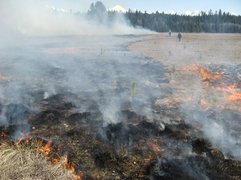
LAKEVIEW, Ore. April 15, 2023 — The Fremont-Winema National Forest plans to start Spring prescribed burning in mid to late April, targeting approximately 20,000 acres across Klamath and Lake counties as conditions become favorable.
For detailed descriptions of locations, please see the table at the end of this release.
Fire managers implement understory prescribed burning to reduce wildfire risk to communities. Prescribed burning reintroduces and maintains fire within our fire-dependent ecosystem by removing concentrations of vegetation and restoring forest health while increasing public and firefighter safety. Once firefighters ignite prescribed burns, they monitor and patrol the units until they declare the burn out.
Firefighters work with Oregon Department of Environmental Quality and Oregon Department of Forestry smoke forecasters to identify conditions that will minimize smoke impacts on people and communities. While prescribed fire managers take significant preventive measures, it’s likely that communities may experience some smoke during or immediately after a prescribed burn. Most smoke impacts occur during the night and early morning hours.
For more information on smoke and air quality, including the current AQI, please visit https://www.airnow.gov/.
| SPRING 2024 UPPER KLAMATH BASIN PRESCRIBED FIRE INFORMATION | ||
| NAME | SIZE (ACRES) | GENERAL LOCATION DESCRIPTION |
| YOTA | 745 acres | 17 miles south-southeast of Chemult. 6 Miles east-northeast of Klamath Marsh. Smoke will be visible from Hwy 97 North of Chiloquin and multiple locations off Silver Lake Hwy. |
| North II | Phase 1: 3,000 acres Phase 2: 2,600 acres | Located 7 miles East/Northeast of Chiloquin approximately between Mile Posts 1 and 4 on Williamson River Rd. Smoke visible from Hwy 97 near Chiloquin and Sprague River Rd between Chiloquin and Sprague River. |
| Ridge | 3,000-5,000 acres | Located 19 miles south-southeast of Chemult and 20 miles north-northeast of Chiloquin. Generally, in the Wildhorse Ridge area near the Klamath Marsh adjacent to Silver Lake Hwy and the Military Crossing Road. Hazard signs will be posted in the area, and traffic control measures including the use of flaggers and pilot cars may become necessary if conditions warrant. |
| Chemult WUI (East) | 1,200 acres | Located immediately east of the town of Chemult. Smoke impacts should be minimal, and hazard signs will be posted. |
| J Lo | 1,000-2,000 acres | Located approximately 15 air miles north of Klamath Falls and 2 miles south-southeast of Chiloquin. Smoke will be visible from multiple locations around the area, including Hwy 97. |
| CUB | 1,500-2,000 acres | Located west of Hwy 97 between Chiloquin and Chemult near the base of the Cascade Mountain Range. |
| Raccoon Rx | 273 acres | Located south of the communities of Rocky Point and Odessa, along Highway 140. |
| Mitten Springs Rx | 650 acres | 10 Miles east of Bly, OR. Visible from Hwy 140 |
| Bly Ridge WUI RX | 1,000 acres | 5 miles west of Bly, OR. on Hwy 140 E. Visible from Hwy 140 |
| Bridge Buck RX | 800 acres | Bridge Creek-Buck Creek/12 miles SW of Silver Lake, OR. |
| Jakabe RX | 750-1800 acres | Coffee Pot Flat-Parker Hills/15 miles SW of Paisley, OR. |
| Prescribed burning requires careful planning and consideration of things like weather, fuels conditions, and resource availability. We anticipate beginning our spring operations in mid to late April and continuing through May or early June if favorable conditions persist. | ||